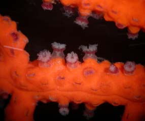
IMES

IMES

Friday, February 27, 2015

Rob - UR - Humble Beginnings of an ArcGIS Project Undertaking...

As I mentioned in my previous blog post, for my Independent Research Project this semester I am working with a database of water quality data obtained by water quality volunteers with the Marine Discovery Center in New Smyrna Beach. This data was collected between Jan 2013 and Oct 2014. In addition to this database, OCE1001 and OCE2013 Lab students have performed water quality sampling and analysis on the Tomoka River in Oct 2014, and Feb 2015.

Although I have not appropriately narrowed down the focus of my IRP, I have decided that I will be using ArcGIS 10.0 software to combine the data with a spatial component and create some type of water quality map that can be accessed by anyone who would like to access it.

So as a preliminary step, I have begun to start manipulating the data so that I will eventually be able to import the entire spreadsheet into ArcGIS. This is a major selling point, since ArcGIS is capable of importing data from a number of different sources; such as Oracle Databases, Access Databases, Excel Spreadsheets, and even CSV (comma separated value) Files. The first item I had to manipulate was the list of locations where the samples were obtained. In most cases, the Latitude and Longitude coordinates of the location were recorded in Degrees/Minutes/Seconds. In order to import the locations into ArcGIS however, the locations must first be converted into Decimal Degrees. This is quite simple, as there are 60 seconds in one minute, and 60 minutes in one degree. To convert to Decimal Degrees, first the seconds are divided by 60 to obtain the decimal value, which is then added to the minutes. The minutes+decimal are then divided by 60 once again to obtain the full decimal value which is then added to the degrees. This gives a full Decimal Degrees value which can then be imported as a point into ArcGIS.

All 31 water quality testing sites relative to map of Volusia County

Zoomed in on the layer of testing sites

Tomoka River Water Quality OCE1001/2013 Lab testing sites

Same sites, different base map

Amanda, UR., The Land meets the water.

As many of you know my project began on land last semester. I walked my neighborhood to see which yards where chemically treated and which were natural so I could avoid chemical lawns when walking my little dog to the park. However, this semester, I'll be taking it to the water!

If you remember the map from my previous post, you'll see I've actually highlighted (in the lavender blueish color) some areas of interest to me for sampling sites. I'm curious if there's runoff from my neighbors using these nasty chemicals.

The chlorophyll readings in the lab from my sample site showed: sample 1 the reading was 15.42  µm/L using 201 mL of filtrate, and sample 2 showed 17.25  µm/L using 100 mL of filtrate.

Per Dr. Woodall, we have the ability to test for nitrogen, phosphorous, and copper. Therefore, that's what I'll be testing. 

I drew a box around the 1 little stand alone body of water that isn't surrounded by houses and isn't accessible via the other water ways. This spot interests me for that very reason; I want to see if it has the same properties or contaminants as the others or none at all.

I'm getting excited!

Courtney, UR- Mysteries of the Horseshoe Crab

The east coast of the United States is home to one of four species of horseshoe crabs found in the world, the Atlantic Horseshoe Crab (Limulus polyphemus). My attempt to find as much research about information on how water parameters might impact horseshoe populations came up empty. In fact there is very little information on horseshoe crabs in general such as how long they live, are they like sea turtles and return to the beach of their birth, why do their spawning cycles revolve around the moon and where do they go 10 months out of the year when they're not spawning? So many unanswered questions that biologists and researchers have yet to answered and this article, Horseshoe Crabs Remain Mysteries to Biologists, touches on this information a little bit. In this article it also touches on how in Maine they tag horseshoe crabs with plastic tags for later identification.
Also I did read somewhere that they can tolerate many different levels of salinity which is one of the important factors that have kept them around for more than 500 million years!


Horseshoe crabs spawning at dusk, Limulus polyphemus, Delaware Bay, New Jersey
mass spawning on the beach

 
There are so many possibilities for an independent research project due to the little know information about horseshoe crabs! Right now because my internship, from what I understand, will involve collecting data that FWC can use in further research and conservation. I am interested in collecting information about what beaches in the Indian River Lagoon do horseshoe crabs prefer and what environmental conditions on these beaches make them so ideal for the horseshoe crab spawning? Once I talk with Annie this week I will have more of an idea of exactly how I want to do my IRP. I feel that there is so much I can do with this and I am really excited to begin my research, the more I read the more fascinating I find these extremely important marine animals!

Thursday, February 26, 2015

Todd UR, Pondering Updates

I am really looking forward to the lab tomorrow on Febuary 27 2015. Mainly because it will be on the Tomoka River downstream from my test site.  It was suggested that I use salinity amounts as my key tracer in my project.  My prediction is that the further I get from the Ocean the less salinity my sample should contain. So far my first practice test holds this to be true. The tool I will use to measure the salinity levels is the refractometer.
SALINITY REFRACTOMETER shown with viewing screen (in background) with a 50 ppt sample applied.
  
According to hyperphysics.edu the average salinity content in the ocean is 35 ppt (parts per thousand)
When I took a test sample last Friday, February 20 2015 at International Speedway Blvd. @ Tomoka River bridge my two samples showed 1 and 0.5 ppt and this is near the start of the River.
I was also advised to take my samples at different depths if I could get some guidance on why this is so important it would be appreciated.   Personal professional experiences would be great guidance!  

Paul Ferguson, UR - Time for a Change

After meeting with Chad Macfie at the Marine Science Center, it looks as though my research might be taking another direction from observing coral in the lab. We sat down and tried for quite some time to develop a study on coral in relation to either food size or current velocity in the lab. There are many ways we could set up experiments to test different factors however the problems arise when trying to determine the results of the experiments. Unfortunately there are few ways to determine how well a coral is feeding. One is as I discussed from looking at other studies which is where groups of polyps are removed and dissected under microscope. This destroys sections of the coral and I cannot do this at the MSC. Another way is to weigh the coral to determine growth however with the growth rates of coral, it would take much longer than allowed. While discussing some of the problems involved, we switched gears to talking about corals specifically in the Indian River Lagoon. We came up with a study we could do out in the environment with a little more real world application. Chad talked to me about a specific area in the Indian River Lagoon that offers a unique chance to research current velocity and the effects it has on growth and succession of marine life. He told me about an area part of a marina with floating docks. There are floating docks in the main river, floating docks in a channel that makes a 90% angle to the main river, then the channel makes another 90% angle and there are more floating docks. What he proposed was picking three of these docks in the same area where the only difference is current velocity, and taking a chisel to the bottom of these three docks clearing a square that can then be analyzed to determine succession rates of marine life with different current velocities. A quick way to sum up succession is talking about clear-cutting a section of forest. Underbrush is the quickest to sprout up, along with other typical fast growing vegetation. The composition of vegetation eventually changes from brush and low canopy trees to hardwoods and evergreens. What we would expect to see after clearing a section underneath these floating docks would be algae quickly covering then being replaced by other more permanent marine invertebrates. These floating docks host a habitat that I think would be interesting to watch as the areas are reclaimed by life.

Wednesday, February 25, 2015

Taylor - UR - Meet the Octopus

From my last post (here), I talked about researching octopus enrichment with the octopus at the Marine Science Center, BUT I forgot to introduce the little octopus!
This octopus species is the Octopus Vulgaris (the common octopus) and they are found around the world in warm waters. As of now, the sex of the octopus has not been identified, but after some research, I found an article that has some great facts about octopus and how you can actually identify if an octopus is male or female. If the third arm on the right side of the octopuses body is slightly different than the rest of the arms and has fewer suckers this indicates that it has a male reproductive organ. (I am still going to call it a "he" as I think it's a male).


The octopus at the Marine Science Center came from the Florida Keys when it was trapped in a stone crab pot and then brought to the MSC for educational purposes. Most octopus can escape after trying to get crabs out of the traps, but some don't get out in time before the fisherman retrieve the traps. These common octopus usually only live 12-18 months, this is due to a poor vascular system even though they have three hearts. We believe that this octopus is a young adult as common octopus do get a little larger than his size.

Some other interesting facts I thought were interesting: Octopus see the same image whether they're upside-down or right-side up due to their pupils being horizontal. Female octopi can lay up to a thousand eggs, but usually die after laying them. Since the only solid body part they have is the beak/mouth, they are able to squeeze through very small spaces that are smaller than their body mass. Another cool fact is that they have blue blood and are the most intelligent invertebrate!


So, there are some cool facts about octopus and the introduction of the one I will be studying for the next several weeks. He doesn't have a name yet, but I will be naming him as soon as I get him a little more social and see his personality (yes, octopus do have personalities). Since I've been able to see him during feeding times, I've gotten a pretty good look at him and to say the least, I absolutely love him!

Sunday, February 22, 2015

Robin, UR..... "How Oyster Mats are Made"

 Until further notice my project is to create  oyster mats without plastic, So I needed to see how the plastic mats were made with the plastic mats in order to get an idea.
 Google provided me with some great images and after talking with Annie Morgan last Friday, it all starts with donations of recycled oyster shells, which are then washed and set to air dry for one to several months, purchasing of plastic matting and zip-ties.
 After the drying process it is now time to drill holes and with large plastic zip-ties they are fasten to the plastic mats as shown below.


 Once the mats are assembled they are transported to destination and with cement sprinkler holes they are again zipped-tied together to hold  them in place.


I hope to continue with this project and if I do my next blog will be on the natural oyster beds and a little comparison in order to get some ideas.


Saturday, February 21, 2015

Jody, UR.... Guess what I found out during my chlorophyll sampling!!!


Graph from Chlorophyll Class


First of all my chlorophyll readings were the highest (surprise!!) of all the samples submitted for lab class with Pond#1 at 35.76 µg/L, and Pond#2 at 34.891µg/L with an average of the two samples at 35.326 µg/L. Here is my graph from class as a comparison. This sample was taken from a pond that is surrounded by golf course on all sides and cannot get it's water from any other source than surface runoff from our property.


 I chose this site having a suspicion that it would have higher numbers because it is surrounded buy golf course on all sides and only has one point of overflow, also it does not get treated (more on that to come). Also we have very recently put down granular fertilizer on the tee's and have had two rain events since, so I am sure the runoff from those rain events has had an opportunity to get in the pond and begin to exacerbate the organic growth.
My future water samples will, I'm sure be more specific for phosphates and nitrates and possibly copper among others, to get a better understanding as to what is going on in these lakes water chemistry with input from these anthropogenic impurities.


In my attempt to not be totally negative on golf course impacts on the environment I have to try and balance my blogs so here is an article I found in my research regarding water birds and golf courses. Even if it is a study sponsored by the US Golf Association I know it has some value because we have a lot of aquatic birds constantly feeding in our lakes. MORE TO COME>>>     


Friday, February 20, 2015

Todd UR, updates

From advice on a prior blog and personal advice given from Dr. Woodall it was suggested that I narrow my ideas.  In doing so my main focus will be:  Does the Tomoka landfill affect the water quality of the Tomoka River?  Important chemicals I want to test for are staying the same:   They are according to Cornell University they do define known contaminants as having "a high biochemical oxygen demand (BOD) and high concentrations of organic carbon, nitrogen, chloride, iron, manganese, and phenols. Many other chemicals may be present, including pesticides, solvents, and heavy metals" (Cornell Waste Management Institute).       
Further advice from the professor suggested that I concentrate more on sampling methods.  some suggestions were : Transect.. dilution, tracer  ….    I am kind of unclear about the tracer method.  I would like further advice on the tracer method aspect because from class I see it used in a reference to determine if air quality is from natural or man made aspects and.  The articles I have read concerning anything tracer, their method uses a dye or something they added to the water to determine flow.  Since the river starts at the area I want to test the direction of the flow is obvious.
Tomoka River 

Amanda, UR, Wading anyone?

This is a sample site for me.
When I pulled up this picture in my phone the lat/long coordinates were actually off a bit, as I note below the following image.

I don't know if you can actually see the little green "x"s that I drew on the map around the water body to the far left; however, if you can, the "x" in the circle is where my phone pinpointed my location and the free standing "x" is where I actually took the photo above. You can actually access all of these lakes by trails or by kayak.
My phone put my lat/long at 29◦16’29.6”N 81◦04’15.0”W, which is actually still in my neighborhood and not at the site where I actually took the picture.

Thursday, February 19th I did go get my very cold water samples from Central Park closest to my house. I now have the lat/long coordinates that I was able to pull up from the computer as 29.273023 lat/ -81.072640 long.
My anticipation is mounting as I await our lab today to see what lurks beneath the surface of these waters.

Thursday, February 19, 2015

Paul Ferguson, UR - Troubles in keeping Gorgonians


While I was not able to meet with the Environmental Specialist at the Marine Science Center and get fully briefed on the specific experiments being conducted at the MSC, I did continue researching Gorgonian care, feeding and flow rates. While researching a question of how to tell how much a coral is feeding, I was able to find one study conducted by the University of Miami in a Marine Ecology Progress Series that discussed in materials and methods, their way of determining this. After allowing these corals to feed on particulate matter, feeding was detected by determining numbers of prey in the guts of 20 randomly selected polyps through dissection under microscope at 40X.
Leptogorgia virgulata with extended polyps
 I read the article Invertebrate Non-Column: Gorgonians discussing the best way to ensure a proper set up and factor in all the requirements to sustain health and encourage growth. While the species discussed in this article are not the specific species I will be studying at the MSC, the same problems must be addressed. Variables such as flow rates, food size, coral position, polyp size all factor in to finding the best possible setup. There are some generalizations that can be made when discussing flow rates and polyp size and that is, generally, the smaller the polyp, the higher the flow rate at which they are able to feed. However, one of the study discussed in this article points out that of the species being studied all fed best at a flow rate of 8 cm/s while another study determined between 10-15 cm/s. Either way, this gives a rough estimate of flow rates at which to start. Also discussed in this article is prey size. As I discussed in my last post, there is a wide variety microscopic prey. While Gorgonians filter feed water, there is a limit to the size of prey items they are able to catch, subdue and devour. Primarily, zooplankton from 100-200 micrometer size range accounts for over 75% of the Gorgonian coral discussed which also has small polyps. The species I will be working with are described as unable to capture zooplankton but feed on particulate matter Artemia cysts. 

Crystal UR - Make way for Wawa!

Adjacent to my work, there is a construction project to build a much anticipated Wawa. What interesting to note about this project is that prior to construction there was nothing there. When I say "nothing," I don't mean a vacant wooded lot. I mean there was nothing but a hole connected to a small sink hole lake. Meaning construction could not commence until the hole was partially filled. I plan to sample the water of this small lake and another pond nearby as a control so see what, if any, havoc construction has caused.


Wednesday, February 18, 2015

Courtney, UR- Biomedical Bleeding of Horseshoe Crabs

Blood harvesting of live horseshoe crabs
Limulus amebocyte lysate (LAL) is a pharmaceutical product that can only be obtained from the blue blood of horseshoe crab, It is used to ensure that vaccines and medical equipment are bacterial free which makes it lifesaving to humans. Each year almost half a million live horseshoe crabs are harvested for their blood and they are heavily bled, taking 20-30% of their blood. Unfortunately about 20-30% also die due the blood harvesting. 

This device is the accelerometer used to track the movements before blood harvesting. 

Researchers in this article, "Biomedical Bleeding Affects Horseshoe Crab Behavior", were curious as to exactly how many of the released horseshoe crabs are falling into the same fate and to help answer this question researchers monitored the movements of captured crabs for a week  before taking blood from them. "Electronic data recorders called accelerometers that measure the crabs’ speed and direction were strapped to their backs and the crabs were placed in running wheels in tanks filled with seawater." It was noticed that the horseshoe crabs moved less and seemed almost disorientated for up to two weeks after the procedure.
spawning horseshoe crabs
Horseshoe crabs are harvested in the middle of their spawning season because they are easily captured by the thousands but if taking their blood alters their behavior in negative ways then could this make them less likely to breed? If so then this could be a huge factor in the declining populations of horseshoe crabs along the east coast of the United States.


Researchers in the recent article believe that with improved capture and transport methods as well as wait until the end of the breeding cycle could drastically improve the declining population numbers of these unique and crucial creatures!


Taylor - UR - An Experiment on Octopus Enrichment

Today I went to the Marine Science Center to speak with Chad Macfie who is the Environmental Specialist and Live Collection manager there along with Dr. Amy Osmon from DSC about an experiment we could work on with the octopus located at the MSC. I was able to see the octopus and get some information on it's personality. Just like most animals, each one has its own personality and ways of going about its instinctive nature. As for the octopus at the Marine Science Center, since they brought him in on January 29th, they have found him to be reclusive and prefer to stay in his lair most of the time. He will come out during feeding times and enrichment sessions with toys and puzzles. Fortunately, I was able to see an enrichment display done by Chad to see how the octopus reacts with toys and give it some "play time." The octopus almost came fully out of his lair during this play time, but it didn't last long until he decided to hide away again.

But what exactly is enrichment? In the article "Enrichment for Giant Pacific Octopuses: Happy as a Clam?" it is explained that animals kept in captivity need environmental enrichment for their well-being. Environmental enrichment is, "an animal husbandry principle that seeks to enhance the quality of captive animal care by identifying and providing the environmental stimuli necessary for optimal psychological and physiological well-being." So in a less confusing definition: environmental enrichment is a principle that stimulates an animals senses to keep it physically and mentally healthy. As an example, the octopus at the MSC will play with toys or try to get food out of a jar or snorkel tube. This gives this invertebrate physical and mental stimulus that keeps them "happy" and healthy. In some ways, its just how humans react to stimuli. When we get bored, we find something to entertain us, if we don't find anything that keeps us entertained then we tend to get tired and unhappy. This goes just for any animal, especially animals with a higher "intelligence" or more adaptive brain. Enrichment also helps with stress and negative behavior. If an octopus is having a hard time adapting to it's environment and is unhappy, it will instigate negative behaviors such as swimming sporadically around the aquarium, hitting their heads against the side of the tank and in some extreme cases, begin to eat themselves (this is a disease that is common in all octopi, but is only exposed when an animal is stressed and their immune system decreases. Such is the same with a human, if you have a virus inside your body and your immune system is weakened by outside sources, the virus will then attack your body.) So, enrichment is an extremely important factor when taking care of captive animals.

So from talking over some of the wonderful articles Chad gave me, working with Dr. Osmon and debating on what kind of experiment we could actually take data on with enrichment, we all finally came up with a plan. The octopus in the aquarium is again, very reclusive; he hinds under a rock with a barrier of smaller rocks and barnacles and doesn't seem very social. Since the octopus is new at MSC, he hasn't been worked with as much except for the feeding times and enrichment periods throughout the day. He is fed raw food, but Chad has introduced a concept that I will be able to play a role in; which will be to introduce live food to the octopus. Over the period of a few weeks, we will be documenting and taking data on the level of activity that is induced from different enrichment and feeding periods, along with timing how long it takes for the octopus to come out of it's lair to interact with us. I will be creating a data sheet that will then be filled out as we watch the octopus interact with it's new surroundings.
There is a lot going into this Independent Research Project and I could not be more excited to see if we can make this reclusive octopus a more social one!

Monday, February 16, 2015

Jody, UR....More Being Reveiled About Golf Course Ponds!

HOLE #16
A few more questions that were asked regarding my IRP on Golf Courses impacts on the Aquatic Environment are as follows. Can you tell us more about the ponds and lakes created for golf courses? e.g., are there size and depths requirements? When they are created, are there steps taken to prevent groundwater seepage? Are they monitored for water quality? If so, for which parameters and how often? 
 I will answer these the best I can from my 20+ years of golf course construction experience and then with a little research.
BIRDSEYE VIEW
There are three main reasons reasons for ponds on golf courses. First as I stated in an earlier post they are in place to capture water (precipitation) to be used as irrigation, because purchasing water from a municipality for said would be cost prohibitive. Second the material (dirt) excavated from them is used throughout the rest of the course to give it it's topography, raised Tee's and Green's complexes and other undulations. These are set forth by the designer on a set of plans and followed by the contractor. And third as you can see by this picture (above left) of  hole #16 a par 3 at my course, they give the course character by adding visual aesthetics and also making play a little more challenging. The size, depth, and amount of ponds/lakes are usually set forth by the designer but site characteristics will usually nudge these specifications a bit.Take for example the the long pencil lake at the bottom center of the picture at left. That is our main lake and it is 11 acres. That is where our pump stations are that deliver the irrigation water to the other 120 grassed acres. I have no idea how deep it is to the bottom but at full pond we have five+ feet of water over our intake for the pumps. Lets see.... that's 17,921,640 gallons if it is five foot deep.  To be continued!


Saturday, February 14, 2015

Robin, UR... Frequently Asked Questions


Hello Everyone it has been a few weeks, but I am here to share a few obscure research hang ups I have.
When I am researching I always find my-self in the "Frequently Asked Question" section and it never seems to disappoint me.


I was searching articles for information on Oyster Bed Restoration when I found myself in the FAQ section and this one question caught my attention: #10 "What are the environmental benefits of the oyster restoration project?" the answers, which I am going to share with you because I believe it sums up the reason, the whole ideal interests me for my IRP.

  •   The reefs will provide an increase in essential habitat available for many species of invertebrates besides oysters, such as shrimp, clams, snails, crabs, as well as may species of fish.
  • A large oyster population will effectively filter more water in the estuaries. When fully populated with oysters, the reefs will be able to filter the total volume of the St. Lucie Estuary in about one month.
  • The improvements in water quality will lead to expanded seagrass growth, which creates important fish nursery habitat.
  • Oyster reefs along with mangrove and other plantings will serve as effective shoreline stabilizers, helping to combat erosion.     


This one FAQ is one of the reasons I wanted to be in the Environmental Science Technology field. The Idea of a little physical outside work, proper education and some guidance, in being good stewards in helping planet earth for future generation is a job I am willing/wanting to take.

Friday, February 13, 2015

Rob - UR - Indian River Lagoon Recovering

Well, after last week's blog post, I wanted to continue on with some more information regarding water quality issues in our immediate area. I came across this article from September 2014 which addresses some of the local happenings. Apparently, some good news is on the horizon as the Indian River Lagoon seems to be making a turnaround after 3 years of being plagued by Brown Tide, waterway clogging algal blooms, fish die-offs and a still unidentified die-off of dolphins and manatees. 


So moving past 2012-2013 and into 2014 and beyond things are definitely looking up. New water quality monitors have been providing a continuous stream of data to be analyzed. The Indian River Lagoon is showing vast improvement in the expanse and density in sea grass beds, and along with this recovery, many other species are returning to repopulate the area including seahorses and crustaceans.

Another area showing signs of improvement are the oyster beds, with a marked improvement in growth over the preceding 2 years. Finally, although the algae which are responsible for the algal blooms of the recent past are still present in the water, they are present in much lower concentrations than before. This also includes the brown tide which is also still present in the water, but has not shown up in any blooms.


Well, this is definitely going to be something to watch. Maybe we will be able to pinpoint some trends in the water quality which might be either a cause or an aftereffect of this improvement in the quality of our local waters.

Thursday, February 12, 2015

Amanda, UR, Illusive information


I've been digging for answers to Dr. Woodall's questions about our fun lake in Central Park (how big it is, how deep, is it man-made?) I do know they are man-made and it's 'rumored' that they are old shale pits that were originally dug for the shale to distribute on dirt roads in the 1960's. All the links I went to just describe the parks and not really the depth of the waters. An interesting side note: they are thinking of setting up an environmental learning area at lake 2.

This picture is a great shot from someone's kayak in the Central Park waterways

This is one of the groovy tunnels they dug to connect the lakes; all 4 lakes are connected now and you can kayak/canoe back and forth between them without land interruption.

Luckily this is ongoing research so hopefully I'll be able to unearth some history on these fun water ways.
I was able to read more on sampling methods: there are sampling methods literally called clean hands (ch)/dirty hands(dh) and grab sampling. The sampling methods are very precise and ch/dh takes 2 people whereas the grab method requires that you're not afraid of alligators because you will be wading!!

Courtney, UR- Frisky Horseshoe Crabs...

So I have decided on doing my IRP on horseshoe crab populations since I have an awesome opportunity with an internship to do a little more research on this unique yet very important marine species. This article, "Beachgoers asked to watch for frisky horseshoe crabs", basically gives a little more of an idea of why horseshoe crabs are important and what needs to be done to help them.


This is an Adult Horseshoe Crab
Horseshoe crabs may look intimidating but they are actually completely harmless and are not related to crabs at all but more to scorpions and spiders! They are vital to coastal ecosystems because many coastal animals rely on the 100,000 eggs that horseshoe crabs lay in a single mating season and if there aren't any eggs then many animals don't eat. Horseshoe crabs are also important to us humans because we rely on the harvesting of their blue blood, which actually does NOT harm the horseshoe crab, for an important chemical, Limulus Amoebocyte Lysate, used to test the sterility of medical equipment and other medical related testing/research.
Populations are declining due to habitat destruction and beach development and there is little documentation on Florida's horseshoe crab population and Florida Fish and Wildlife Commission can use all the help it can get on getting more information. As a child I pretty much grew up on Florida's coast and I used to see horseshoe crabs all the time and was always fascinated with them so I am really excited to be able to help with the research and documentation of these unique and vital marine creatures.
This is a picture of a baby horseshoe crab


Paul Ferguson, UR - Azooxanthellate Coral... Hard to Pronounce, Even harder to Keep Alive


       I recently made contact with Chad Macfie, who is an Environmental Specialist II over at the Marine Science Center. He is the manager of Live Collection and Life Support there and referred me to an article in order to get me on board with what we plan to research. This article, Non Photosynthetic Corals,  discussed the difficulties in keeping this variety of soft corals alive in a closed system. Azooxanthellate corals differ from zooxanthellate corals in that they do not share the symbiotic relationship with the photosynthetic dinoflagellates. Azooxanthellates must therefore derive their energy to grow and recolonize from filter feeding tiny microscopic zooplankton.
Leptogorgia virgulata

Leptogorgia virgulata
      Part of the difficulty in keeping these corals alive in a closed system is determining what kind of food each coral will survive and thrive on. Some zooplankton are just too large for the coral to be able to capture, hold, and deliver to its mouth. Another major concern is current strength. All of these species have a threshold for optimization of feeding. In a slow current, their tentacles within a polyp orientate upstream in order to capture prey, while in a fast current, they face downstream to create an eddy. As the flow rate increases, their ability to feed increases, peaks and then decreases as the rate of flow continues to increase.
       The species I will be conducting my research on is the Leptogorgia virgulata. This species is located right in our backyard in the Indian River Lagoon and there are many questions to be answered with this species of azooxanthellate coral. This species occurs on ledges, inlets and the intracostal waterway. I haven't narrowed down exactly what my research will include or what specific question I hope to have answered, though I am thrilled at the opportunity to research something I have always thoroughly enjoyed learning about.

Wednesday, February 11, 2015

Todd, UR; Are we swimming in garbage?


Landfills take great measures to protect groundwater but do they do enough to stop surface run off, especially when they are built approximately 2,000 ft from a river and it’s headwater?  
The West Volusia Beacon Online tells its readers that The Tomoka Landfill has "good surfaces to drain rainwater.  And, the rainwater becomes leachate as it filters through the trash, and it must be collected and processed before it is allowed back into the environment." 

What types of chemicals are associated with surface water runoff? What types of chemicals are associated with leachate holding ponds and contaminated groundwater near landfills?
     According to Cornell University they do define known contaminants as having "a high biochemical oxygen demand (BOD) and high concentrations of organic carbon, nitrogen, chloride, iron, manganese, and phenols. Many other chemicals may be present, including pesticides, solvents, and heavy metals" (Cornell Waste Management Institute).     Using well known groundwater contaminants as a example is not a good idea because Cornell explains that there are other local variables to be taken into consideration therefor the local landfill can not be held at fault.
     
Does the Tomoka Landfill lie within a Flood Plain or Watershed?
From Google maps one can tell that this landfill is within approximately 2000 ft.  from what is the starting point of the Tomoka River, does something like this matter?  
    According to the EPA  "Headwater streams are the smallest parts of river and stream networks, but make up the majority of river miles in the United States. They are the part of rivers furthest from the river's endpoint or confluence with another stream. Many headwater streams have been lost or altered due to human activities such as urbanization and agriculture, and this can impact species and water quality downstream.
Watershed managers have had little guidance to help protect headwaters or assess their condition. Because there are so many headwater streams, monitoring all of them for health and permanence is impractical. Therefore, other methods are needed".

How will I know if this landfill lies with in sensitive areas?
I will use GIS to show the "Natural Floodplain and Wetlands" from a existing shape file data.  


Taylor - UR - Octopus Behavior

As of this week, I finally decided that I will be studying my IRP on octopus behavior instead of studying sharks. They're my favorite animal so this is perfect! I have read articles and watched many videos on the intelligence of octopus and have always been fascinated by their capabilities that have been so underestimated until recent years. This article called, "How Smart is an Octopus?" really goes into detail about what the intelligence of an octopus really is and some of the amazing skills it's learned. Octopi have been known to mimic other animals, disguise themselves as coral by changing colors and even being enclosed in a jar and freeing itself (watch it here). When they talk about the "intelligence" of an octopus, they're not talking about the IQ score of and octopus but the adaptations and skills they're brains have evolved to be able to accomplish. I also found it quite amazing learning that they have about half a billion neurons in their lobed "diffuse net" which is much like human brains; AND they also have the biggest brains of all invertebrates.
I think all of this is so fascinating that I am planning on working with an octopus at the Marine Science Center in Ponce Inlet to possibly do some behavior tests on it. There are many possibilities for what I could research, but finding one to really put to the test is hard to find. I would love to try and "teach" the octopus how to do something such as open a jar to get food out or even try and reinact the same octopus in the YouTube video freeing itself from a jar. I will be talking with Chad Macfie in charge of the Marine Science Center Aquariums about some other ideas I could possibly do with the octopus.

On a side note, this is going to be one of the most exciting things I have ever done and possibly one of the happiest days of my life. I have always wanted to work with an octopus one on one and I now will have my chance! I don't think anyone understands just how excited I am!

Monday, February 9, 2015

Jody, UR... Answers to some Questions

MOSQUITO LAGOON  
North America's most diverse estuary.
One of the questions asked buy Dr. Woodall regarding my topic on Golf Courses and their impact on the environment was. How many golf courses are there within the Indian River Lagoon drainage basin and how much area (acres, square miles, percentage?) does this represent? Although this is a very dynamic question to answer specifically, I will try to throw some light on it. Look here for a  interactive map to most of Volusia County's Golf Golf Courses. Keep in mind some of the pointers are not 18 hole golf courses at all, some are putt-putt's, a couple are driving ranges, and some are just golf shops. But the nearest I can count is approximately 20 full sized courses along the I-95 corridor in Volusia County. As far as the Indian River Lagoon drainage basin part of the question I'll need to do some research regarding where that line is (more to come on that). As far as acreage the average 18 hole course requires about 120-150 acres. One other item that has to be considered is, Golf Courses are designed topographically to keep all the precipitation that falls on the property on site. Most all of the surface water drains to the ponds/lakes which are then connected and drain to a central lake on property. That water will then be used for irrigation when needed and a lot of irrigation is needed, in the summer we put down close to 180,000 gallons a night. A lot of time and expense is taken to rid the course of excess surface water quickly and store that water for future use. So only in extreme precipitation events will this water have a chance to leave the property. What I'm trying to get to is most of the chemicals we put down to keep the grass so green do not have much of an opportunity to leave the property. Just saying... not trying to defend!!!
INDIAN RIVER MARSH
 (More to come) Indian River Lagoon Watershed Stats - The following information is quoted from this same webpage>
"Size of Basin: 155 square miles
Major Cities and Towns: New Smyrna Beach, Titusville, Cocoa, Rockledge, Merritt Island, Melbourne, Palm Bay, Sebastian, Vero Beach, Cape Canaveral, Cocoa Beach, Satellite Beach, Indian Harbour Beach, Indialantic, and Melbourne Beach
Counties: Fifty percent of the watershed lies within Brevard County, and smaller areas lie within Volusia and Indian River Counties (I Did not count Golf Courses in Brevard County)
Major Water Features: Ponce de Leon Inlet, Jupiter Inlet, Mosquito Lagoon, Indian River Lagoon, Banana River, and St. Lucie River and Estuary".